




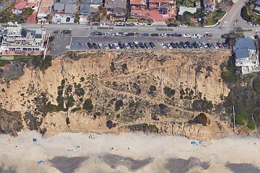
A four-year Scripps Institution of Oceanography study found that sensors installed in coastal bluffs detected movement hours to days before five collapses, supporting development of an early warning system along California’s erosion-prone coast.
The institution, part of UC San Diego, announced the study’s findings July 9.
Researchers monitored cliffs at Beacon’s Beach in Encinitas, along the coastal railroad in Del Mar and at San Elijo State Beach in Cardiff. They concluded that, in most instances, deformation sensors can provide reliable warning of an impending collapse at a monitored location, but they noted that more research and emergency-response procedures are needed before the findings can become an operational warning system.
Process and results
Equipment detailed in the report included commercially available and higher-resolution tiltmeters, mechanical and optical extensometers, a seismometer, optical displacement and height sensors, and a weather station. Researchers also used truck-mounted lidar and drone mapping to document changes in the cliffs.
“While others had reported signals that preceded landslides, we wondered what we would see in this environment,” geophysicist Mark Zumberge said in a UCSD news release announcing the findings. “Scientists have been trying to predict earthquakes for a very long time. This study provided a unique opportunity to leverage what we’ve learned with earthquakes and apply it for these coastal hazards.”
The team documented two collapses in Del Mar and three at San Elijo State Beach, ranging from a few cubic yards to several hundred cubic yards. Sensors detected movement before every failure.
“Our team selected locations where we anticipated cliff activity could happen, but we had no guarantee,” coastal geomorphologist Adam Young said in the news release. “The five events provided vital data to inform our findings that this type of monitoring can enable prediction.”
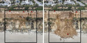
One of the clearest examples came in Del Mar on April 21, 2024. Researchers found a crack about one-tenth of an inch wide running 30 feet parallel to the cliff edge. It widened about 0.015 inch per day — too slowly to notice visually — before sensor readings began accelerating April 19. Researchers alerted coastal managers, and roughly 200 tons of material fell to the beach at about 5 a.m. two days later.
Scientists also conducted weekly lidar surveys from Torrey Pines State Beach to Encinitas between 2022 and 2025 and compared cliff changes with rainfall records. Their analysis identified preliminary thresholds associated with increased landslide activity, potentially allowing regional warnings when rainfall and other conditions elevate the risk. Waves erode and steepen a cliff’s base, while rainfall and groundwater can help trigger failure.
Research at Beacon’s Beach was less conclusive. A major landslide closed the access trail in May 2022, and a reactivation in January 2024 moved several feet and again damaged and closed the trail. Permitting complications also delayed installation of the most sensitive instruments. Data from those sensors did not become available until 2025, leading researchers to recommend longer monitoring before determining whether the higher-cost equipment is useful there.
The report cautions that one event produced repeated cycles of accelerating and stabilizing movement that could have led to false alarms. Researchers said the five documented collapses are too small a sample to make reliable prediction routine.
In all, researchers identified about 4,300 erosion events in the lidar record. Their preliminary analysis found a 70% probability of a large failure somewhere in the study area within four weeks after a day with more than an inch of rain, although they cautioned that the calculation is based on a relatively short period of observations. A large failure was defined as exceeding 50 cubic yards of material.
The study also found that landslide debris traveled an average of 19.7 feet from the base of the cliffs, with 90% of measured runout distances under 43 feet.
Study born out of tragedy
The project grew out of Assembly Bill 66, introduced in 2021 by Assemblymember Tasha Boerner (D-77th District) after three women were killed in an August 2019 bluff collapse at Grandview Beach in Encinitas. Boerner secured $2.5 million through the state budget for the project, while AB-66 established the monitoring and reporting program. Subsequent legislation under Assembly Bill 72 authorized the Scripps research.
AB-66 required the research to be completed by Jan. 1, 2025, with a report due by March 15, 2025. The University of California lists the report as submitted March 30, 2026, and Scripps announced it publicly July 9.

“Bluff collapses are a constant threat to coastal neighborhoods in my district and across the California coast, presenting the risk of fatalities, injuries, and millions of dollars in damage to vital infrastructure,” Boerner said in UCSD’s news release. “With this study completed, the science is clear: We can save lives, protect our coastal economy, and vital transportation networks in the face of sea-level rise with a bluff-collapse early warning notification system. This could not have been possible without Dr. Adam Young and the rest of the team at Scripps Institution of Oceanography.”
The report recommends that the state work with lifeguards, coastal managers, rail operators and other agencies to decide who receives alerts and what actions follow. Responses could include temporary beach or clifftop closures, continuous monitoring, warning signs or controlled removal of unstable rock.
Researchers also developed an experimental mobile-friendly tool providing hourly, three-day forecasts of beach width at four Torrey Pines State Beach locations. The report calls for public education, longer monitoring at existing sites and research in other vulnerable parts of California.
“Some of the most significant landslides occur infrequently, and additional long-term observations are needed to better understand them,” Young said.
This report was partially written using artificial intelligence, then updated, edited and fact-checked against source material by North Coast Current staff. View our AI policy on the About Us page, and read more in a column by our publisher.
