


Carlsbad CA— During a public hearing on the city’s updated coastal land use plan Tuesday, city staff cleared up questions from the community and City Council members about what development is and is not allowed, why the plan doesn’t result in changes to land use, and next steps for increasing coastal park space south of Palomar Airport Road.
Change in name, not use
One area of discussion had to do with changing the name of a certain land use.
- When the city’s updated General Plan was approved in 2015, the land use designation called Tourism Recreation was changed to Visitor Commercial, which is a more commonly used term in planning documents.
- According to city planners, the intent of both names is the same – commercial development meant to serve the needs of visitors and residents.
- Some speakers thought the change from Tourism Recreation to Visitor Commercial meant a change in land use.
- That’s because in the city’s updated General Plan, the definition of this land use was longer with more examples of uses.
- However, all of the examples added would have also been allowed under the previous name, Tourism Recreation.
- Housing is not allowed on this property.
Power plant site
- The updated Local Coastal Program Land Use Plan doesn’t change the planned use of this land (except by removing a “utility” designation from where the Encina Power Plant is currently being demolished. The 2015 General Plan designated this site for visitor commercial and open space uses).
- Housing is not allowed on this site.
- The Local Coastal Program Land Use Plan only establishes the way land can be used, not specific projects.
- Any proposed projects in the future would undergo a planning process that includes input from the public followed by consideration by the City Council and California Coastal Commission.
Strawberry fields site/South shore of the Agua Hedionda Lagoon
- The Local Coastal Program Land Use Plan does not change the use of this area.
- Housing is not allowed on this site.
- The portion of the strawberry fields adjacent to I-5 has been designated for visitor-serving commercial and open space uses since the 1980s.
- Most of the strawberry fields are designated as open space, with just the portion along the freeway set aside for visitor-serving commercial development.
- The strawberry fields land use in the city’s Local Coastal Program Land Use Plan is the same as what Carlsbad voters approved in 2006, including 48 acres along the freeway that could be developed for visitor-serving commercial uses. This option was chosen over a competing ballot measure in 2006 that did not include the commercial use.
- In 2016, Carlsbad voters overturned a City Council decision to approve a development plan for the strawberry fields property proposed by developer Rick Caruso. That vote overturned the decision to approve the plan, but it did not change the land use on the property.
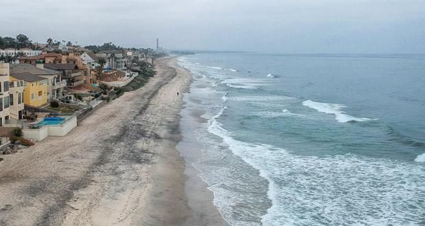
South Carlsbad coastal park
Another topic generating a lot of questions and discussion Tuesday was a property in the Ponto area that many local residents would like turned into a park.
- This property has been designated partially for housing and partially for general commercial use since 2015, when the city’s General Plan was approved.
- The property owner has already started the application process for a project on this land, and a lawyer representing the owner said Tuesday that her client was not interested in selling the property or turning it into a park.
- In some cases, cities can force private landowners to sell their property for a public use, but Carlsbad’s city attorney explained Tuesday that this can only be done for an urgent city need that could not be met by other public land.
- The City Council recently asked staff to start the process for identifying how about 60 acres of city-owned coastal land south of Palomar Airport Road could be turned into park uses.
- City staff plan to start gathering input from the public on the use of the 60 acres in early 2022.
The Local Coastal Program Land Use Plan is one of the final steps in the comprehensive update of the city’s General Plan, an overall blueprint for how to manage the city’s physical, social and economic resources. In 2015, the City Council approved the city’s new General Plan, following five years of public input and technical work. The coastal plan is now being updated to be consistent with the approved General Plan.
Cities along the coast of California are required to have a Local Coastal Program to show how they will comply with the California Coastal Act and ensure the public has maximum access to the coast and to protect coastal resources.
A draft update of the coastal land use plan was released in October 2019, followed by a series of public workshops, surveys, community presentations and additional outreach. The Planning Commission recommended approval of the draft update in January 2021 after three days of public hearings.
Next Steps
The City Council approved the Local Coastal Program Land Use Plan Tuesday, which means it will now go to the California Coastal Commission for review and approval. If any concerns are raised, city staff will work with Coastal Commission staff before the plan is presented to the full Coastal Commission at a public hearing. This entire process is anticipated to take one to two years. Any revisions to the plan would be brought back to the City Council for approval.
The public input process for the city-owned land along south Carlsbad Boulevard will start in early 2022.